Digimap for Schools now contains a wonderful new addition that many of you have asked for over and over again – aerial photography!
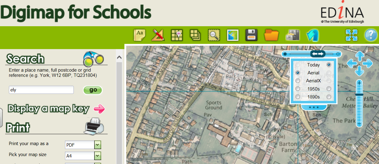
The aerial photography shows magnificent detail and clarity - it's cloud free for all of Great Britain, something you won't get anywhere else! You can now compare and fade Ordnance Survey maps, historical maps and aerial photography with our new enhanced Map Chooser (shown). It's simple to use and offers maximum flexibility.
We've also added new learning resources to accompany the aerial photography. Be inspired with ideas such as using aerial photography to introduce learners to travel, transport and trade or discuss marks we humans leave on the landscape that can be seen in aerial imagery. Both excellent ideas to get you started with aerial photography.
To make you get the most out of this new addition to Digimap for Schools, we've created a short introductory video which explains the difference between Aerial and AerialX, the info tool for discovering exact dates the aerial photography was flown in your area of interest and a map key showing the patchwork of years stitched together to form this seamless dataset.
And of course there is a revised Help section on How to .... fade between map types.
Here's the video, and more videos and webinars are on the Digimap for Schools YouTube channel.
Here's the video, and more videos and webinars are on the Digimap for Schools YouTube channel.

